Our services
Airborne Magnetic
Surveys
A magnetic survey can map out changes in the amount of magnetic minerals as well as associated rock types. Thus, a magnetic map can help locate mineral deposits by identifying specific rock types and geological features.
Topographic Surveys
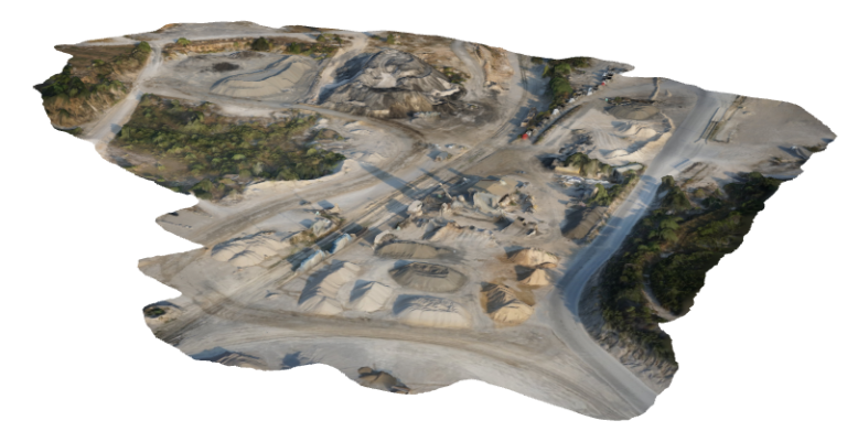
A topographic survey locates all surface features of a property, and depicts all natural features and elevations. In essence it is a 3 dimensional map of a 3-dimensional property showing all natural and man-made features and improvements. Specifically, it shows their location, size, height and any changes in elevation.
Thermal & Infrared Imaging
Thermal Imaging is the perfect tool for building diagnostics, and The Infrared Camera combined with drone technology can detect structural and thermal deficiencies in large scale commercial and industrial premises. An infrared aerial scan will locate deficiencies in inaccessible buildings, large scale electrical installations and solar power systems, in a fraction of the time it takes for close-up inspections.
Advanced Drone Training
We Offer Drone application based training to RPL students who are interested in learning about the different use cases and safe practices.
Aerial Inspection and Analysis
From the data drone data output we able are to document construction projects with progressive shots, and also carry out change detection for environmental monitoring projects.
Creative Aerial Content
Our creative team is able to provide aerial photograph and video shots
Drone Repurposing and Repair Services
Zanifi Team has developers capable of repurposing different UAV brands.
Drone Data Processing as a Service
We provide drone data processing as a service for different drone data output.